An upgrade in cellular technologies has returned global positioning satellite capabilities to my joggling runs. Previous GPS technologies involved the use of hand held Garmin eTrex units. Running and juggling deprives me of the ability to hand carry a GPS unit. The recent acquisition of an LG Optimus II P715 has provided GPS capabilities while running and juggling. Arm mounting a GPS on a joggler produces a suboptimal antenna orientation, but given that the platform is a cell phone, the unit performs rather well. Google Tracks provides app support with maps, even out here beyond the outer edge of paradise.

By the GPS I did not return to where I started, but then a run does change one. One probably never does return to quite the same place as where one was where they left. Maybe the GPS unit is a philosophical unit, but more likely the GPS unit lost satellite signals under the trees up into Dolihner.
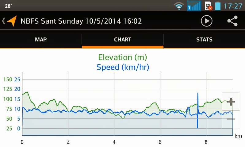
Although the details are not accurate, the general elevation trend echoes the actual run. I start about a 100 meters above sea level, descend to sea level, and then return to 100 meters above sea level. The speed data seems overly optimistic.
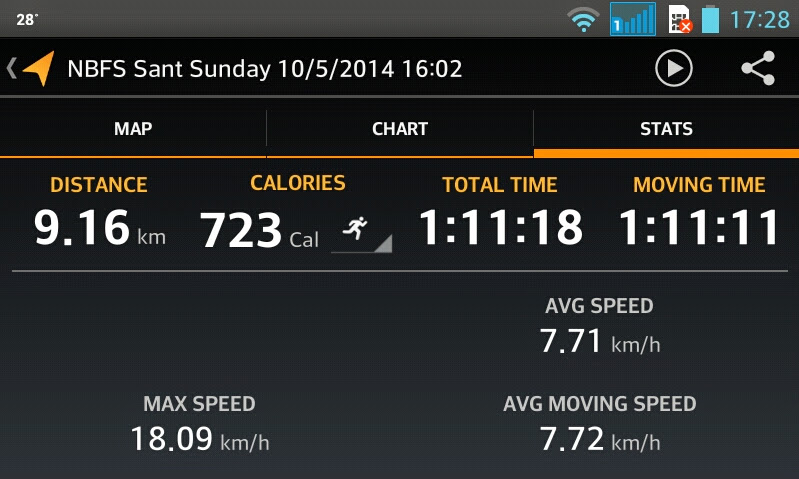
The third screen has a variety of numbers. The calories burned is rather meaningless, and the maximum speed is the result of loss and regain of signal. 18.09 kph is sheer fantasy – the spike can be seen on the earlier chart.
To say one went for an hour run does not have the sense of documentary reality that the LG screen shots convey. Underneath the images is a KMZ file with universal date time stamps, coordinates, and altitudes – some 3000 rows of data, of numbers:
<when>2014-10-05T05:07:18.767Z</when>
<gx:coord>158.203917 6.954549 114.19999694824219</gx:coord>
The 3000 rows of numbers feel, to a numerophile, to be even more real than the images. Images can be photoshopped; generating 1500 coherent, correctly geolocated date-time-longitude-latitude-height in meters data points is a far more daunting task. Easier to just run the route and collect the data. And a lot more fun.
Near the end of the day ask yourself two questions. Have I seen any interesting numbers today? Did I run today? Did you?
